
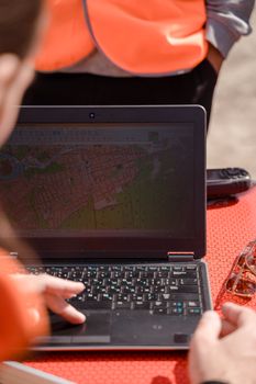
You type “gis jobs near me” into a search bar, but the results seem oddly limited. One listing requires years of experience, another is actually hundreds of miles away, and several promising roles do not even include “GIS” in the title. The problem may not be a lack of local opportunities. It may be that employers use many different names for work involving geographic information systems.
A smarter search looks beyond one job title, targets organizations that depend on spatial data, and shows employers that you can turn geographic information into useful answers. Here is how to find strong openings in your area without wasting time on irrelevant or outdated listings.
Start With More Than “GIS Jobs Near Me”
Searching the main keyword is a useful first step, but it should not be your entire strategy. GIS skills appear in government, utilities, engineering, transportation, environmental management, public safety, real estate, telecommunications, and other fields. Some employers advertise these positions under specialized titles rather than labeling them simply as GIS jobs.
Run several searches using your city, county, state, or ZIP code alongside titles such as:
- GIS analyst
- GIS technician
- Geospatial analyst
- Mapping technician
- Cartographer
- Remote sensing analyst
- Spatial data analyst
- Asset management technician
- Planning technician
- Survey or mapping technician
- Geospatial developer
- Location intelligence analyst
Also search by skill or software instead of title. Employers may mention ArcGIS, QGIS, Python, SQL, GPS data collection, LiDAR, remote sensing, geodatabases, web mapping, or spatial analysis in the description. Combining one of these terms with your location can uncover openings that a basic search misses.
Look Where Local GIS Work Actually Happens
GIS professionals help organizations understand where assets, customers, infrastructure, environmental conditions, and public services are located. That means local opportunities often exist in places that job seekers overlook.
Government agencies
Check career pages for cities, counties, regional planning organizations, transportation departments, tax assessment offices, emergency management agencies, and state departments. A county may need mapping support for parcels, roads, elections, utilities, zoning, or public safety even when the position has a general administrative or planning title.
Utilities and infrastructure employers
Electric, gas, water, wastewater, broadband, and telecommunications organizations maintain detailed records of physical assets. Search for jobs involving utility mapping, network records, asset management, field data, infrastructure planning, or computer-aided design. Engineering and surveying firms that serve these organizations may also hire entry-level technicians.
Environmental and planning organizations
Environmental consulting firms, conservation groups, universities, forestry operations, and urban planning departments use spatial information to study land, water, wildlife, development, and natural hazards. Relevant openings may emphasize data collection, research, permitting, environmental assessment, or planning rather than map production.
The Bureau of Labor Statistics overview of cartographers and photogrammetrists explains how mapping professionals collect, analyze, and interpret geographic information. It also identifies government and architectural, engineering, and related services as important employment areas.
Use Location Filters Carefully
Job boards do not always interpret “near me” accurately. A posting assigned to a company’s headquarters may involve work at another office, while a role labeled remote may still require residence in a particular state. Set a reasonable radius, then read every location section carefully.
Try separate searches within 10, 25, and 50 miles. A wider radius may reveal hybrid positions that require only occasional office visits. Search nearby counties and metropolitan areas individually because employers sometimes list a regional office rather than the actual work site.
Do not ignore remote openings, but confirm whether the employer has geographic restrictions, travel requirements, or fixed working hours. A fully remote GIS position may attract applicants nationwide, so a local hybrid role can sometimes offer a more manageable applicant pool.
Evaluate the Opening Before You Apply
A good listing should provide enough information to judge the role. Look for a recognizable employer, specific duties, a clear work location, realistic qualifications, and an application process connected to the organization. Verify that the position still appears on the employer’s official career page whenever possible.
Read the required and preferred qualifications separately. Employers often describe an ideal candidate, not the only acceptable candidate. Consider applying when you meet most essential requirements and can demonstrate related experience through coursework, internships, volunteer projects, fieldwork, or a portfolio.
Be cautious if a supposed employer asks you to pay an application fee, buy equipment from a designated seller, deposit a check, or provide sensitive financial information before a legitimate interview and formal hiring process. Vague duties, unusually high pay for simple work, and communication through personal messaging accounts are additional warning signs.
Make Your Resume Easy to Match
Recruiters need to see your relevant skills quickly. Place a concise technical skills section near the top of your resume and use terminology from the posting when it accurately describes your experience. Avoid sending the same general resume to every employer.
Describe outcomes rather than listing software alone. Stronger bullet points might explain that you cleaned parcel data, built a field collection workflow, created a web map, automated a repetitive task, or analyzed service coverage. Include the type of data, the tool used, and the purpose of the work.
If you are new to the field, class projects can count as evidence of ability. Present them professionally and explain the question you addressed, your method, and the final result. A small portfolio with two or three polished projects is usually more helpful than a large collection of unfinished maps.
Build a Portfolio That Solves Real Problems
Your portfolio should show more than attractive map design. Employers want evidence that you can organize data, choose an appropriate analysis, check accuracy, and communicate findings clearly.
Useful project ideas include mapping access to public services, examining traffic incidents, analyzing flood exposure, documenting tree coverage, creating a local trail map, or building an interactive dashboard from public data. Remove private or restricted information, provide context, and briefly describe your workflow.
Include readable legends, sources, dates, and explanations of any limitations. If you used code, a geodatabase, or a web application, explain what it contributed. The goal is to help a hiring manager understand how you think, not merely which buttons you can click.
Reach Employers Before a Job Is Widely Advertised
Local professional associations, planning meetings, university events, map groups, conferences, and career fairs can reveal opportunities before they become prominent online. Former classmates, instructors, internship supervisors, surveyors, planners, engineers, and environmental professionals may know which organizations are expanding their mapping work.
Prepare a short introduction explaining your strongest GIS skills, the type of problems you enjoy solving, and the geographic area where you want to work. Ask for information and advice rather than immediately requesting a job. If you prefer meeting employers directly, this guide to finding open interviews in your area offers practical preparation tips.
Create a Repeatable Weekly Search Routine
Set alerts for several titles and skill combinations instead of relying on one search. Review major job boards, government career portals, employer websites, and professional networks on a regular schedule. Keep a simple record of the position, employer, closing date, application status, and follow-up date.
Apply promptly, but do not sacrifice quality. Tailor your resume, select the most relevant portfolio example, and write a brief explanation of why your skills fit the organization’s work. When you combine broader search terms with targeted applications and visible project experience, the search for GIS jobs near you becomes much more focused—and far more likely to uncover a genuinely good match.